
Montana Cadastral is a database provided by the Montana State Library. It provides information about private and public land ownership in Montana, including geocode, property tax, owner names, addresses, and assessed value information. You can search by geocode, owner, address, assessment code or subdivision, and/or zoom into specific parcels directly. By selecting specific properties, you can view and print their information. Click here to get started on Montana Cadastral.
Quick Terms
Geocode
A geocode in the Montana Department of Revenue’s Orion appraisal system is a 17-digit property identifier that is the primary database key between the map and Orion database. In most cases it is unique to a tax parcel polygon although exceptions can be found. It is geo-referenced in the sense that a user could determine the county, township, section and quarter section of a property from the first 9 digits with the assistance of the four-digit township code lookup table (digits 3 through 6) for the townships in Montana.
Owner
An individual or group of people who own a physical or intangible entity, such as land, buildings, or other assets.
Address
A collection of information used to give the location of a building, apartment, or other structure or a plot of land.
Assessment Code
A property assessment code is assigned to every Property Index Number (PIN) for the purpose of property assessment. This classification determines the type of property (unimproved, residential, commercial, and industrial). It helps determine the property’s tax status and assessment level.
Subdivision
An individual or group of people who own a physical or intangible entity, such as land, buildings, or other assets.
Basemap
A basemap is a fundamental building block of cartography that provides geographical context to a map. It serves as a visual framework upon which other additional layers with thematic data are overlaid. Basemaps include background reference information such as landforms, roads, landmarks and administrative boundaries.
How to Search
On the left side is the search widget which allows you to search by owner, geocode, address, subdivision, assessment code or certificate of survey.
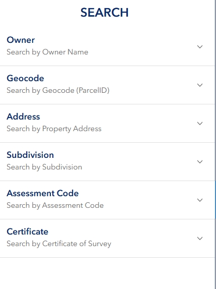
When viewing search results, you have the option of adding all results to the map or selecting individual results to add to the map. The map will automatically zoom to the selected results and property details will be shown in the property information panel.
How to use Quick Zoom
To find the quick zoom widget, look at the icons on the top-right side of the map and click the one with a magnifying glass and plus symbol. This tool can be used to quickly center the map on a county, city, reservation, or township, range and section. You can also zoom in and out using the plus and minus tools on the bottom-left side of the map.

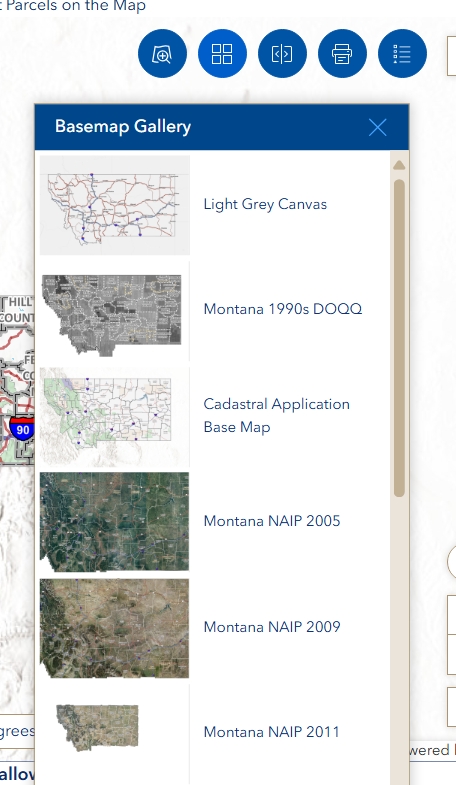
How to use Basemap Tools
Montana Cadastral uses the Esri World Imagery basemap by default but offers a wide range of other ways to view the map, including topographic, terrain and NAIP imagery from various years. To change your basemap, loot at the icons on the top-right side of the map and click the one with four squares.
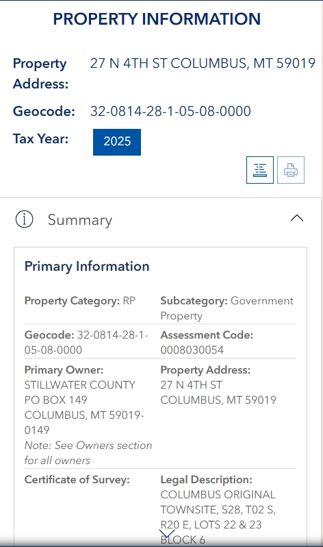
How to View Property Details
Select a property using the search results or click on a property on the map. You must zoom the map in to view property lines and make a selection. The right-hand panel will query the MSDI Cadastral API and return all relevant information for the property (geocode) of interest. the property information panel will default to the most current year, although the user can choose to view previous tax year’s information if available.
Further Questions and Learning
If you need a more in-depth tutorial, please see the Montana Cadastral User Guide here.